Wellington

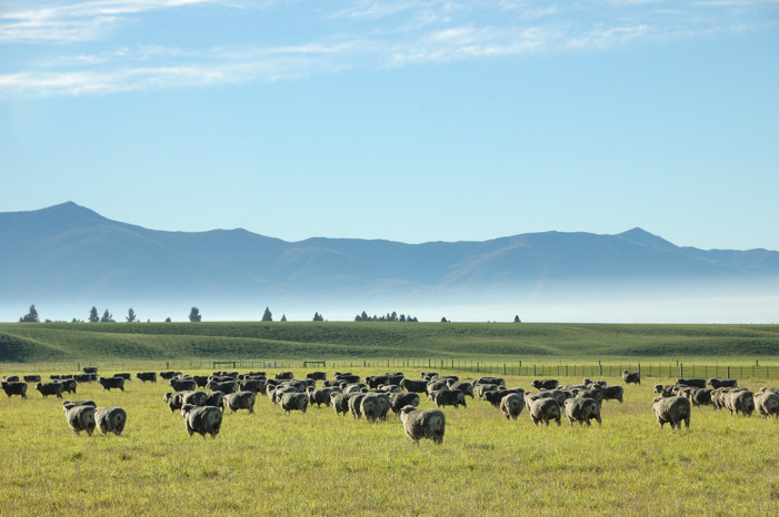
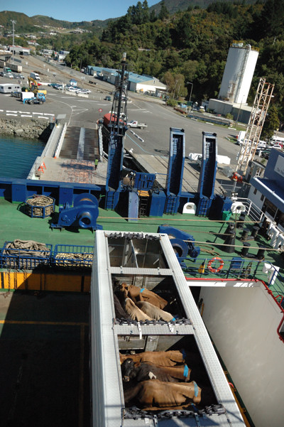
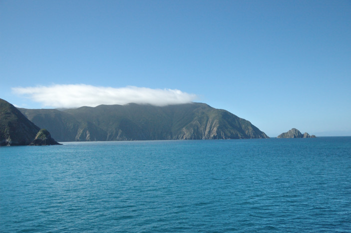
On our final day on the South Island we drove to the picturesque port city of Picton to turn in our rental car and catch the ferry to Wellington. Although we allowed what seemed like ample time for that process, Ted almost missed the boat. It turns out that there are two ferry services that make this run and, although their docks are next to each other as the crow flies, because of the way the port is organized, they are about 2 miles from each other by road. We figured that out, got to the proper terminal, and dropped off our (too) many bags, only to discover that the only place to drop off the car was at the other ferry terminal. After much racing around, Ted did succeed in turning in the car and getting back to the ferry office in time to be the last on the bus that carries walk-ons onto the ferry. This was a huge ferry, with two decks holding cars and tractor-trailer trucks carrying shipping containers, logs, and the unhappy cattle that you can see in the picture on the right. The picture below seems fitting as a last image of the wonderful South Island.

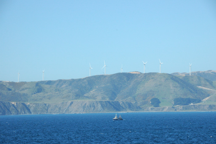
Our first image of the north island was the wind-turbine dotted ridge shown below.

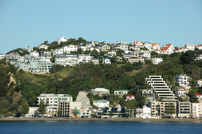
After a 4 hour cruise, the ferry arrived about 40 minutes late into Wellington, where it docked at the heart of downtown, across from the railway station to which we would return in 37 hours. Wellington, like so many of the coastal cities in New Zealand, has a location that was undoubtedly chosen for its protected harbor and not the ease of building a city given the steep terrain. The photo below shows the Roseneath section of Wellington.

We were met at the ferry by Jackie Sommerville. She and her husband William had become quite friendly in Ecuador, with the Hardestys, who were good friends of ours in Chatham who had two daughters about the same age as Taylor and Haywood. When she heard that we would be in Wellington, Kathy Hardesty suggested that we would enjoy meeting the Sommervilles and helped us get in email contact. We suggested meeting for dinner; however, in what seems to be typical New Zealand style, they countered that we should stay with them for our two nights in Wellington. Not only did the put us up and help us get around the city, but that night, they fed us a sumptuous lamb dinner joined by the daughter Suzanna and her partner Simon. (We did manage to take them out to dinner our second night. We went to the restaurant in the Intercontinental Hotel where we had a wonderful meal.) Suzanna and Simon are both a year or two older than Taylor and about to embark on OE – Overseas Experience – year, which seems to be something that most educated young adults from New Zealand do. They will be leaving established jobs to travel (at various times with each set of parents) in Asia for a month before going to London for at least a year. Because they are from a Commonwealth country, they can get reasonable visas that will let them work in the UK, where they hope to be able to find good jobs that will further their careers and also allow them to visit Europe. This was all quite interesting to learn about given the things that our girls are pondering for the next year.

Jackie and William are the principles in an export firm, Asil Group Limited. Their firm exports products  that come from the sea in the Pacific Islands, mainly bêche-de-mer, trochus shell, mother of pearl shells, green snail shell, giant clam shells and seaweed. They are also the sole exporter of Whittaker’s chocolate and handle other food exports, mainly to Asia. They are lovely, interesting people, and we certainly enjoyed meeting them and hope to see them again someday.
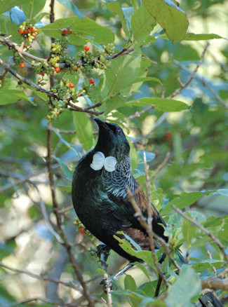
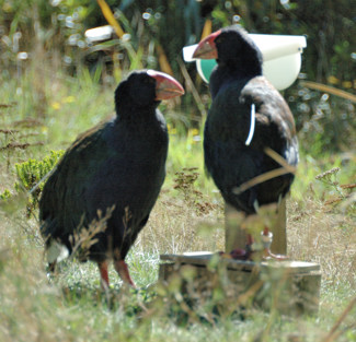
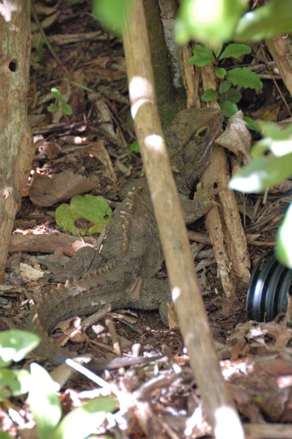
We had many plans for our one full day in Wellington. However, we decided to go to Zealandia first and enjoyed it so much that we ended up spending the entire day there. Zealandia is a hilly area roughly a mile square just ten minutes from the center of Wellington that is being turned into a preserve for many of the endemic New Zealand species that have almost become extinct since the introduction of mammals – primarily rodents, possums, and stoats, but also cats and dogs. For the most part these plants and animals have only been able to survive on small, offshore islands that, because of their size and location, did not have these mammals introduced. Zealandia is unique, however, because of its location on one of the main islands within a major city. To create Zealandia, it was necessary to create something of an ecological island (or living ark as they call it) by erecting a fence around the entire area able to exclude the predator mammals. This proved no small task as the animals are adept at climbing, jumping, burrowing, etc. Having built the fence – that seems to be working – it was necessary to eradicate all of the predator mammals within the area, a process that took several years. Since then, for the last 30 years, they have been slowly eliminating non-native plants and introducing the endangered animals: e.g., kiwi, tuatara (a slow living, lizard like animal that split from the rest of the animal kingdom before the dinosaurs; pictured below on the right), frogs, tui (pictured on the right), takahe (pictured below on the left). One of the measures of the success of this enterprise is that not only have these species flourished within the reserve, but their populations have been spreading outside as well.


The next day we boarded the Tranz Scenic Overlander train for the 12 hour ride from Wellington to Auckland. Although this was a much better way to see a lot of the North Island than the equivalent drive would have been, it was not the truly spectacular train trip that some of us had hoped for.
Posted in New Zealand | Leave a comment

Abel Tasman National Park

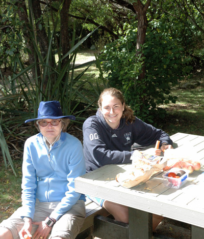
From Murchison, we drove to the north end of the south island. Our destination was Marahau, the southern gateway to the Abel Tasman national park. We parked our car there and took a water taxi north into the park to Anchorage Bay. Here we are eating lunch at a campsite there.

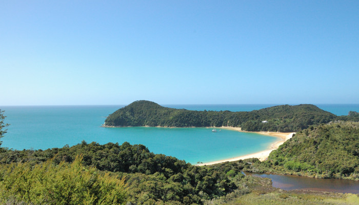
This park, the smallest of the New Zealand national parks, was created in 1942, to commemorate the two hundredth anniversary of Abel Tasman’s arrival in the area. Tasman was a Dutch seafarer, explorer, and merchant, best known for his voyages of 1642 and 1644 for the United East India Company. His was the first known European expedition to reach the islands of Tasmania and New Zealand and to sight the Fiji islands. Although the park is the home of one of New Zealand’s Great Tracks, it is, as you can see in the picture below, as much a water park as a land park, and it includes a large marine reserve.

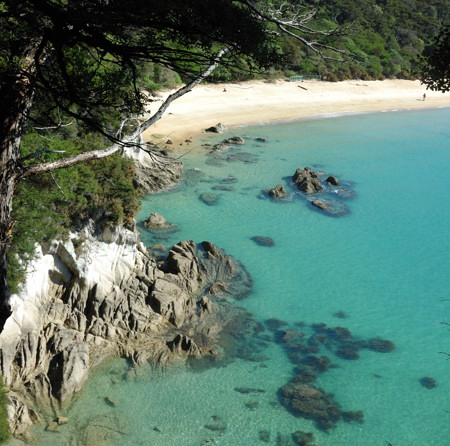
People come to this park for its clear waters, golden sand beaches, granite cliffs, and great weather. In the summer, the southern end of the park is usually crowded with visitors, many from New Zealand. But now, at the end of March, we shared the beaches and hiking trails with only a pleasant scattering of other people, despite the poor weather of yesterday having finally cleared out, giving us two fine fall days here with bright sun, highs of 80 degrees, and pleasantly warm water.

One of the attractions here is ocean kayaking. I think if we had known more about the area and had had enough flexibility in our schedule  to wait out any poor weather, we would have preferred to have spent more of our time here kayaking rather than walking. This coast here is also a favorite for spot for boating, and Anchorage Bay, as its name suggests, is a place in the summer where many boats anchor.
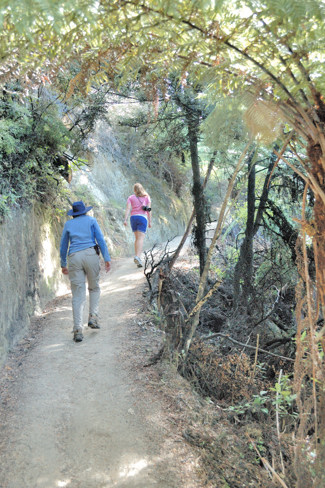
Although it would have been fun to kayak, we certainly enjoyed the hiking and the beaches. As the photo on the left below shows, the hiking trails here are pleasantly flat. Nina particularly appreciated this, having found the rough trails we encountered on the Milford Track and elsewhere hard on her legs and feet.

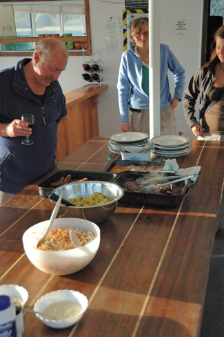
Although there are several (now very expensive, even though they have no road access) houses that are grandfathered into the park, there are few accommodations other than campgrounds and DOC huts. We spent the night at one of the two, Aquacampers, a small boat moored in Anchorage Bay. It has been converted so that it has 5 double cabins – Nina and I were in one of these, a space just large enough for a double bed, which had been carved out of one side of the bridge, and two sets of 5 bunks near the waterline. Haywood slept in one of these bunks and was happy that we were onboard first so that she could pick a bunk that allowed her to extend her legs somewhat into a storage area at the foot – these bunks were quite narrow and short. Besides a place to sleep, they provided us with dinner and breakfast for a quite reasonable rate.


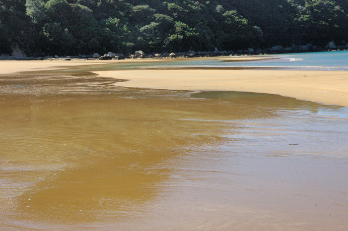
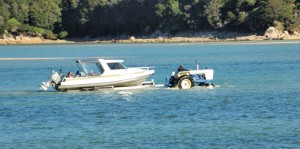
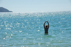
Water taxis provide an interesting way to get in and out of this park. The ones we used are specially built boats with outboard motors that can carry up to 16 people or several kayaks and somewhat fewer people. Because there are no docking facilities on the beaches of the park, these boats are essentially run up onto the beach and then, using a winch connected to the anchor, pulled back off the beach into the water. Their base in Marahau is outside of the park. However, because the harbor here does not have a deep channel and the tides are high, it also does not make sense to have docking facilities here. Instead, as you can see in the picture to the right, tractors are used to take boat trailers out into the water. When the boats come into the harbor, they are driven up onto these trailers, passengers and all. On the trailers they are then pulled onto the shore and driven down the road to the company’s base. We used a water taxi on our first day to go from Maharau to Anchorage Bay. The second morning we were picked up at Anchorage Bay and taken to Bark Bay. We walked from there 11 km to Awaroa Bay, where later, we were picked up a final time and taken back out to Marahau. The picture on the left below was taken at Bark Bay. One the right below, you can see Haywood swimming at Awaroa Bay.

Awaroa Bay is the site of the second, non-camping accommodation in the park, Awaroa Lodge. We stopped there after our hike for a nice lunch. This would be a wonderful place to stay if travelling on a large budget.

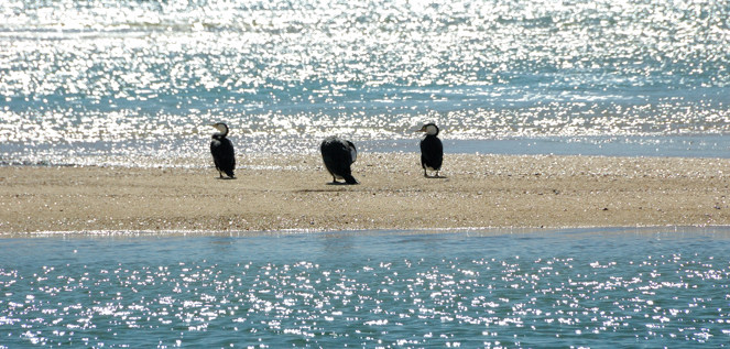
We had seen shags (or cormorants in the rest of the world) in Dunedin and saw them again here. I’ll end this post with a picture of them on the Totaranui Beach at the north end of Awaroa Bay.

Posted in New Zealand | Leave a comment

Lewis Pass and Rafting on the Buller Gorge

Today, we had to say goodbye to Taylor at Christchurch. She flew from there to Auckland where she planned to have dinner at a great restaurant with a friend from Culinary School, and then leave at 7 AM the next morning for New York. We know that she made it safely to the states, but haven’t heard any details about the dinner.

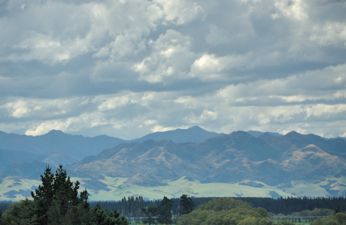
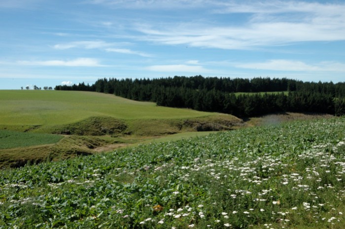
We had a long travel day; however, it was not nearly as arduous as we had originally planned. Today we crossed the third of the four passes across the Southern Alps that can be done by car. (We will cross the last of these two days from now driving to Abel Tasman.) After lunch with Taylor, we dropped her off and drove north from Christchurch through pasture land made dramatic by threatening skies.

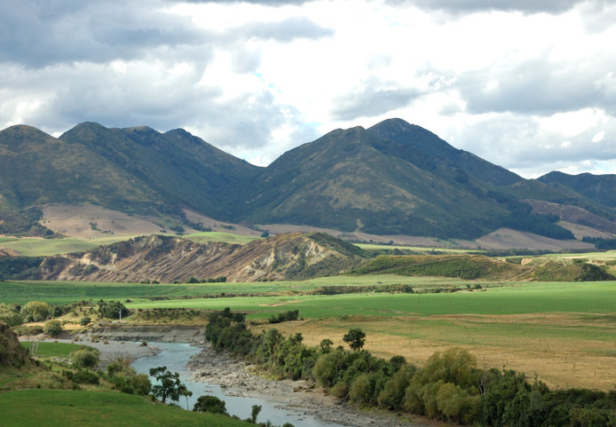
We then headed west, along the Waiau River to Lewis Pass, which you can see below. Our destination was just on the west side of the pass, a “motel” situated on a working cattle farm. Although this place only had three units, one of which was empty, and it was situated in the middle of a farm, this was definitely not a “farmstay.” It was not really possible to walk anywhere on the farm becuase everything was fenced off. Also, unlike everywhere else we have been, where the proprietors have been incredibly friendly and eager to talk, here a woman met us, took our money, showed us to our room, and that was the last interaction we had with her, although we did see her spreading some fertilizer on the pasture in front of us in the rain.

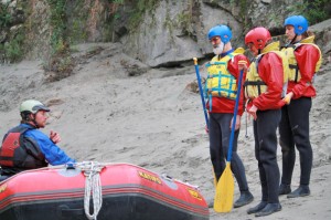
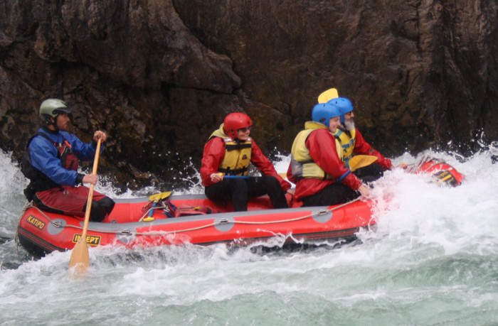
The next morning we continued on to Murchison, a two hour drive, where we had made reservations for the night several months ago. Originally we had planned to drive here from Dunedin in one day, a drive that would have taken 10-11 hours. By avoiding the long drive, we were able to get to Murchison before noon. Murchison, at the confluence of several wild rivers, is a center for hiking, fishing, and water sports. We had hoped with a free afternoon to go hiking; however, the threatening bad weather of the day before, although forecast to clear out, held on as intermittent rain showers today. Given that it was going to be a wet day, we decided to go with the flow and try white water rafting. Perhaps because it was Sunday afternoon or simply because the weather was not great, we were the only ones to go out with Tim, the owner of Ultimate Descents rafting company. In the picture on the right, Tim is instructing us in useful skills: how to paddle, which we didn’t have to do much of, and hold on. Although the rapids were fairly tame, becuase the river was low, it is clear in the picture below that we had a good time.

That night we stayed and had dinner at the Murchison Lodge, a wonderful bed and breakfast that might be our favorite of all the places we have stayed.

Posted in New Zealand | 1 Comment

Otago Rail Trail, Naseby, and Oamaru

Leaving Dunedin, we drove up into Central Otago. The last three days in Dunedin had been rainy and gray, so we were heartened to see blue sky as we loaded the car. However, as soon as we climbed out of Dunedin onto the Otago plateau we found ourselves in heavy fog. Our plan was to ride bikes on a section of the Otago Rail Trail and this is certainly not what we wanted. The Rail Trail is 140 km of the roadbed of a railroad, which was built during the Otago gold rush, that has been turned into a hiking/biking trail. Along its path, it crosses several ridges and valleys. Fortunately, as we crossed into the valley where we would be riding, the fog just disappeared.

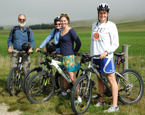
Our destination was Lauder, which was one of the station stops on the old railroad. We were staying at the Lauder Hotel, a 5 room establishment that occupies a renovated building that used to serve as the station. Although it is a hotel, the larger part of its business comes from being the local bar and restaurant. The hotel rented us 4 bikes, and Gerald, the owner-proprietor, drove us to a high point on the trail called Potato Hill just past Oturehua. (We liked Gerald and the Hotel.)

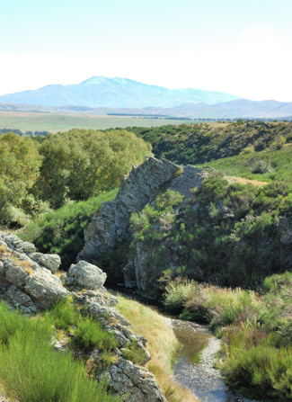
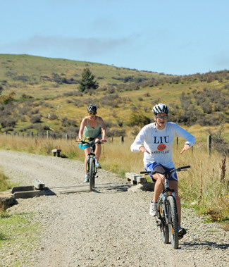
Because it was built as a railroad, the grades on the trail are never steep, making it a relatively easy ride. The entire trail is typically done in 3-4 days; however, I believe that we were all happy, once we had finished our 33 km section, that we were not doing more. Although the biking is easy, the roadbed is made up of large gravel, so the ride was quite rough even though our bikes had heavy duty shock absorbers. Notice that I said high point as we had cleverly arranged it so that most of our ride back to Lauder was downhill. You can see some of the spectacular scenery that we were traversing to the right and below.

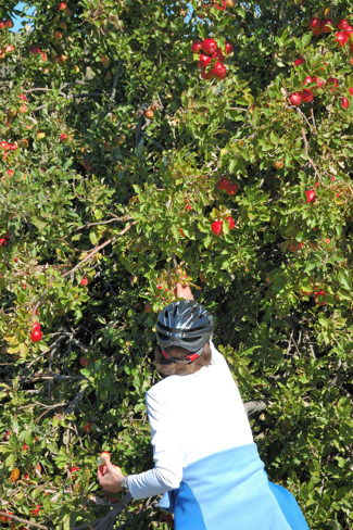
Going downhill you might think we could have covered the 33 km in no time. However, the trail was rocky, and I, at least, got nervous when I started going even moderately fast. Of course, such concerns did not stop all of the daredevils in the group. However, another reason that the ride took us four hours was that there were many things to stop and look at. Here Nina is picking apples from a tree that is growing wild on the trail — or maybe once a settler’s cottage had been here.


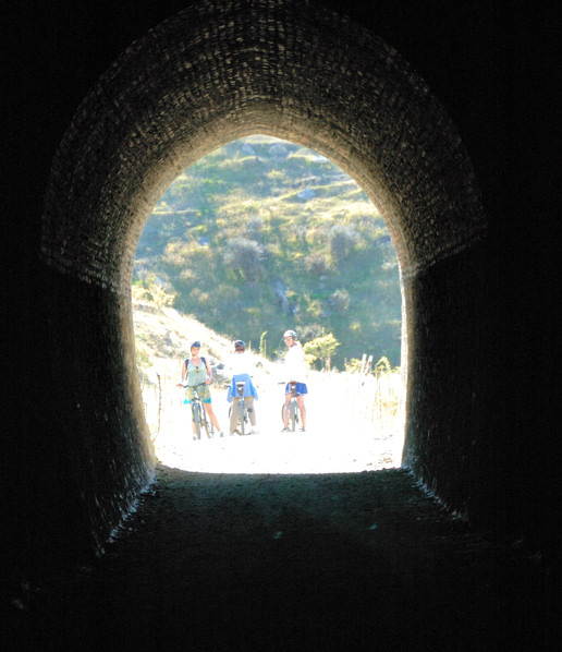
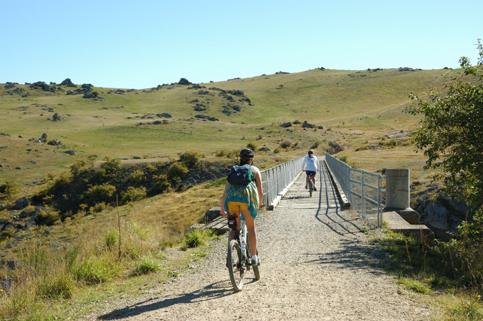
Attractions along this segment included two long tunnels (700+ feet) and several bridges. It is amazing to imagine these being built (the tunnels are through solid rock) in the middle of the 1800’s by small crews of men using basically hand tools.

Near one of the tunnels we stopped at the ruins on an encampment where these workers lived for 3 years while building this section of the line. All that remains are chimneys, but just from the spacing it is clear that the huts these men lived in all this time were quite small. This is the river near this encampment

And here are the girls near that river.

The next day, we left the Lauder Inn and made the short drive to Naseby, an old gold mining town that is now a small alpine resort area. It was another gorgeous morning, as you can see in the two photos below.


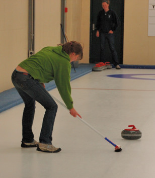
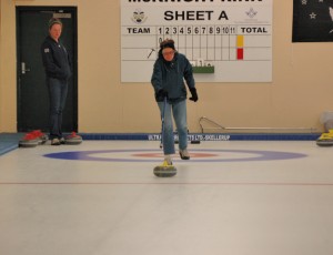
One of Naseby’s current claims to fame is the only indoor, Olympic-size curling facility in the southern hemisphere. Of course, we had to stop and give it a try. On the left, Nina is sending a stone down the ice. Serious competitors do this by sliding with the stone along the ice, getting the speed and alignment correct, before releasing the stone. Not being quite up to this, we pushed them with these shuffleboard-like sticks. Once the stone is sliding, each team has an opportunity to influence its speed and path by sweeping the ice in front of it. This can make the stone go 6-8 feet further. On the right, Taylor is showing her Olympic sweeping form. Curling refers to putting a slight spin on the stone that will cause its path to curl at the end — although we tried to do this, we never really succeeded. (Also, if you must know, the team of girls trounced the team of parents.)


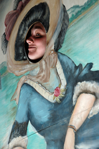
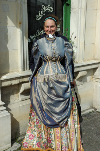
We continued on to Oamaru, a coastal town known for its buildings, constructed from local sandstone. This sandstone is still quarried and, we saw, used by artists all across the South Island. Oamaru has made an attraction of its well preserved downtown and its historic heritage. Here are the girls modeling bits of that heritage.

Also in Oamaru, we visited the Whitestone (after the stone) Cheese factory. Whitestone is an artisan cheese maker that makes cheese in small batches and ships it around the world. The cheese factory itself was not much different from places like this we had seen before; however, the we enjoyed several of the cheeses that we sampled and bought a larger piece of one of them.

The next day we had to drop Taylor off at the Christchurch Airport, so she could get home to empty her apartment, the lease for which ends at the end of March, and find a job for the Spring — I’ll let her explain her future plans. To be able to get her there on time, we wanted to get at least as far north as Timaru, before we stopped for the night. However, we had made plans to eat at the Riverstone Cafe in Oamaru. To kill an hour before dinner, we just relaxed in the wonderful Oamaru Public Gardens.

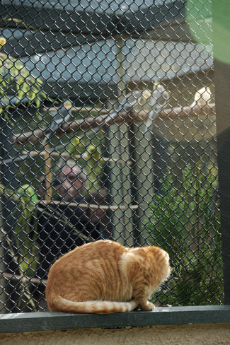
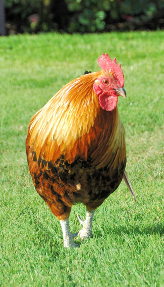
While we were there we made two friends. On the left below is Orange Kitty, a very friendly, apparent stray who enjoyed watching the birds in the aviary — they seemed completely unconcerned — and being petted by us. Haywood, who had enjoyed and now is missing the company of one of the cats that belonged to another of the tenants in their Brooklyn apartment, would have loved to spirit this cat away. Also, strolling through the public garden was the impressive chicken on the right below. Inevitably, the cat and the chicken met; it was a hilarious draw.


Our dinner at Riverstone Cafe was quite pleasant. The restaurant is part of a complex that seems to include plant nursery, petting zoo, and an amazing kids play area — we just don’t have combinations like this in the states. They emphasize locally grown food, some of which appears to be grown in their own show gardens.

Posted in New Zealand, Uncategorized | 1 Comment

Last Week in Dunedin

Amazingly, in seemingly no time it was the start of our last week in Dunedin. We had decided early on in our stay to host a “thank you” party at a local pizza bar called Filadelphios for Liz, her family, and the students in her lab, who had all contributed to the success of our visit. When this party came to pass, on the Monday of our last week, we were 19 in all. Filadelphios was a good choice because they serve a large variety of standard and highly unusual pizzas — including vegan and vegetarian as well as a gluten free one for Nina. Also, the four of us had our first encounter with wedges: essentially huge, heavily seasoned French fries that could easily be addictive. All in all, the evening seemed to be a success.

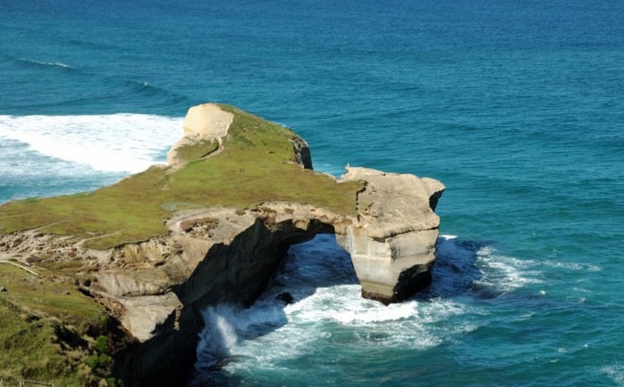
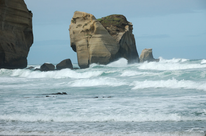
You may recall that an earlier post described Liz and Mike taking the two of us to Tunnel Beach. Haywood had been particularly interested in getting to see it in person. With many things to do and not the best of weather, there was not a chance to get there until the afternoon of Wednesday, our last day in Dunedin. That morning, Ted had given a lecture about a research project of his to a group of about 30 students and faculty. After lunch, following 3 days of steady rain, the skies began to clear, so we decided to give the beach a go. This was a wonderful decision as our second time there was very different from the first. On our first visit, it had been bright and sunny but the sea and been calm. On this afternoon, the skies were just clearing and, as you can see below, the surf was pounding.

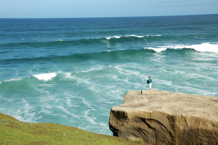
Another difference was that on our previous visit we did not venture onto the headland that protects the south end of the hidden beach, because Liz and Mike did not want their three-year old son Matai running loose on this area with steep, unfenced cliffs on all sides. Of course, it’s not clear that we wanted Taylor running loose near these same cliffs.

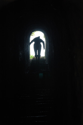
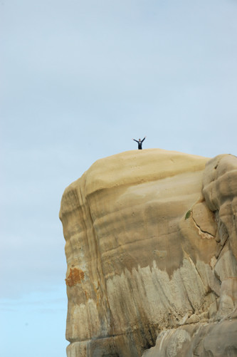
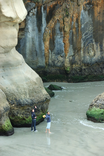
In our first blog post about Tunnel Beach we mentioned that it got its name from the tunnel with stairs cut through the rock to give the daughter of the gentleman who had built a castle above the beach access to a private beach where she could swim.  This visit, I got a picture showing that tunnel. Here you can also see how high the cliffs of the headland are above the beach.


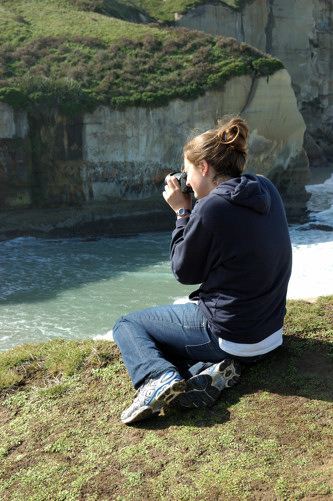
However, the biggest difference was simply being there with the girls. Below, on the right are Taylor and Haywood walking on the beach as seen from up on the headland. On the right, Haywood is doing one of her favorite things.

Posted in New Zealand, Uncategorized | 1 Comment

Aramoana and Mike & Liz’s Place

Liz Franz, who was Ted’s host at the University of Otago, her husband Mike, and their son Matai have a wonderful house on 23 acres of land near the opening of the Otago Harbor. Liz bought this property, which was a hillside sheep pasture with a small cottage and woolshed, soon after she immigrated to New Zealand from the US. She bought the property because she fell in love with its rolling hills
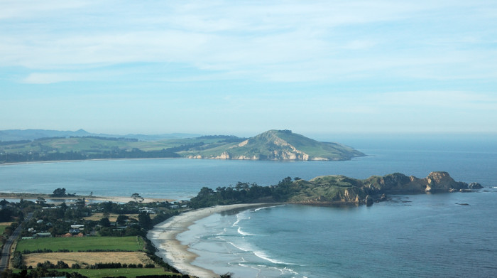
and the views from it out over the Otago Harbor.
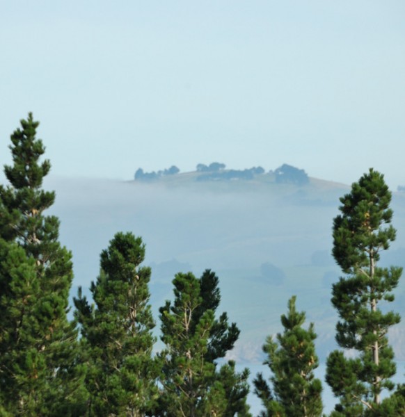

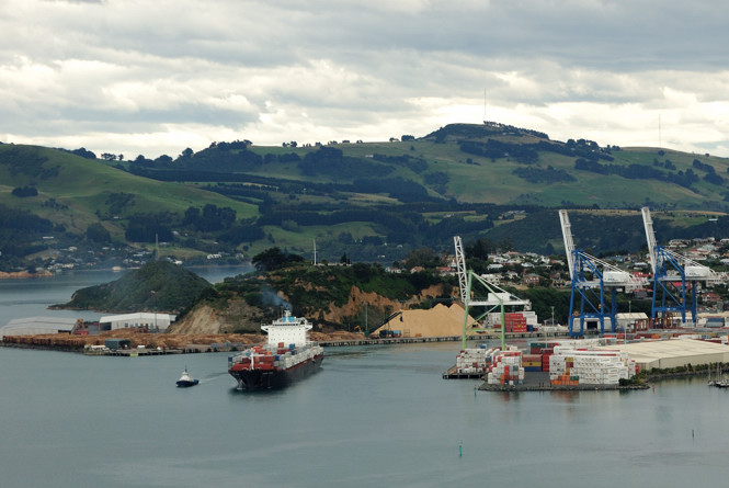
It is located a little on the ocean side of Otago Harbor from Port Chalmers, Dunedin’s deep water port where cruise ships and large container ships such as this one dock. The channel through the harbor to open water is truly serpentine, so watching these large ships as the head in or out can be fun.
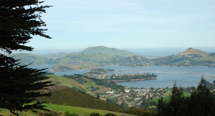
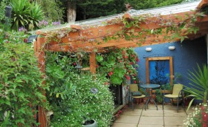
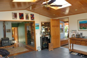
After Liz and Mike were married, they planted trees, added flower and vegetable gardens, and have begun restoring much of the pastureland to a more natural state. They also constructed an addition that joined into one house the two structures that were on the property when Liz bought it.  You can see some of the landscaping in the shot on the left of the entrance. The view of the inside on the right below, shows how well the addition joined the existing buildings.


We visited their home twice. The first time was for dinner on the Friday when Taylor and Haywood arrived in Dunedin late in the evening on a bus that they had ridden for twelve hours from Picton, which is at the north end of the South Island. The second time was Sunday, two days later, when we stopped there on our way to Aramoana so that the girls also could see this fabulous place.

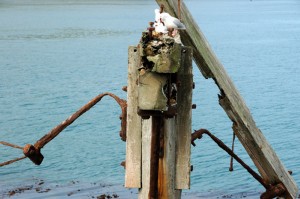
Aramoana is at the ocean end of the Otago Harbor on the mainland side. There is a small community there, consisting mostly of holiday homes. However, most of the land is either park or pasture land. At the end of the harbor is a pair of breakwaters at right angles. One guards the mouth of the harbor. The second, shown below on the right, extends the channel of the harbor. Before Port Chalmers was constructed, this used to also be a jetty where ocean going ships would anchor. Now what is left of that dock provides roosts for gulls.


Across the mouth of the harbor on the peninsula is the headland on which is the albatross reserve that we had visited two weeks before.

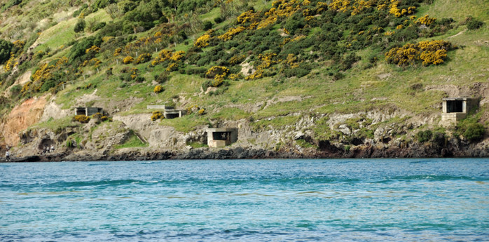
Although we did not see it, that headland conceals a large “Disappearing Gun.” Back in 1856 there was the distinct possibility of the Brits and the Russians having a set-to about Afghanistan. The more things change, the more they stay the same, right? But nervy New Zealanders took to defending their harbors with heavy artillery and here is where they installed a 6-in Armstrong breach loading gun, regarded as state-of-the-art high-tech when it was installed. It’s called a Disappearing Gun because it is mounted in a pit below ground level. When the loaders were ready to fire, the gun popped up, shot off, and the recoil lowered it back below ground again, jazzy stuff in the era of pre-intercontinental ballistic mass-destruction 1885. What we could see was the gun emplacements built during World War II.

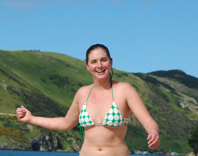
We enjoyed a picnic lunch on the beach formed by the breakwater that protects the harbor. It was a fun place to sit and walk; Taylor even took the opportunity to swim, although the water was cold enough that the rest of us confined ourselves to, at most, wading.

Posted in New Zealand, Uncategorized | Leave a comment

Excursions around Dunedin

Since coming to Dunedin, we have taken a number of small trips on the weekends.  Both Saturdays, we have gone to the Dunedin Farmers’ Market.   The first Saturday it was raining, but the second was better.  The Market is very good; it doesn’t have as many stalls as the Irvine market, but it has more variety.  We have bought chicken, lamb, venison, and fish there, as well as vegetables and cheese, and baked goods.

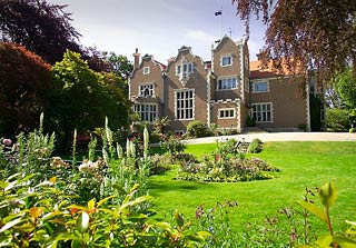
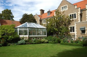
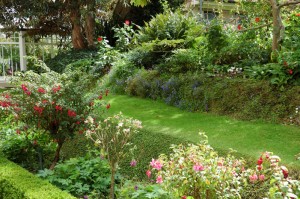
Saturday of the first weekend we made an excursion to Olveston, a stately home only about two blocks from our apartment (can a two block walk be an excursion?).  The house was built by the Theomins,  who made their fortune importing Sheraton furniture from England.  Eventually, their daughter who never married ended up giving the house to the city.  It is believed that because this gift was planned before her father died, she made no changes in the house.  So it remains a well-preserved relic of wealth in the Victorian era. The house is only shown on tours and we found ours quite interesting.  They don’t allow photos of the inside. I could not get a good shot of the front because of some hedges; however on the right is one that I have borrowed from their website. Below are photos of the back of the house and of a part of the garden.


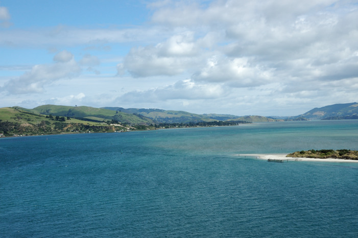
Sunday we drove out to the end of the Otago Peninsula. (I mentioned this excursion, which I am only now describing, in the post for last weekend.) This Peninsula forms the south side of the 20 km bay that is called Otago Harbor.

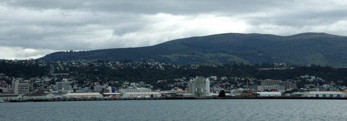
Here is the part of Dunedin in which we live from the other side of the harbor. Our apartment is on the hillside close to the center of this picture.

This is looking away from Dunedin, out along the harbor, from about the same place.

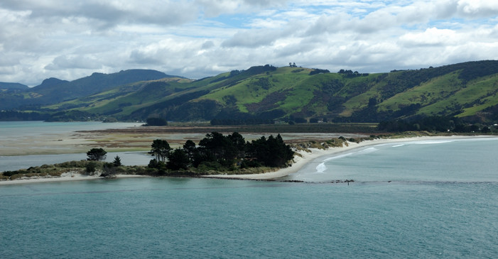
The road that runs all the way to the end of the peninsula is a narrow, twisty road that follows the shore, usually close to the waterline. Even after all the mountain driving we had done in previous weeks, this was a hard drive. We were rewarded, however, with some excellent views. This is almost at the end of the harbor looking across to the mainland near Aramoana. The spit of land acts as a breakwater for the harbor. In the trees are several houses, one of which used to be the harbormaster’s house. Nina thought it would be a wonderful place to live; Ted was dubious about how it would be in a bad storm.

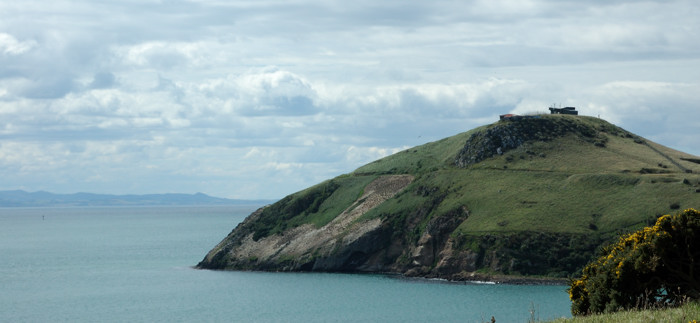
The photo below looks out to the headland at the end of the peninsula. This is a sanctuary here for the Royal Albatross an endangered species that builds its nests above the cliffs. Also here are Blue Penguins, Fur Seals, Sea Lions, and the rare Stewart Island Shag, about which more later. Beneath the reserve lie the tunnels of Fort Taiaroa, established over 100 years ago to counter the anticipated threat of invasion from Tsarist Russia.

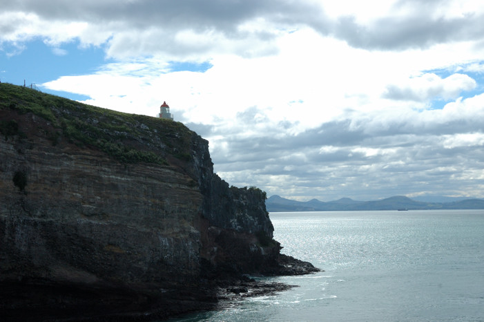
These are the cliffs on the other side of the headland. Although we did see several albatrosses flying at a distance, we never saw any birds land  nor from this distance can one see the nests; however, there were busloads of people at this lookout with us. Still I thought these cliffs were beautiful. Inevitably, for a steep price, it was possible to be taken to a blind where you could observe the birds up close. We did, however, see a video of an albatross up close, for free, in the Royal Albatross Center and you can see some wonderful pictures if you follow the link to their website.

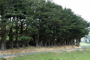
There is a second road that runs from the mainland about two-thirds of the way out to the end of the peninsula. We took that on the way back. The fact that it is called Highcliff Rd. tells you that the driving on it was no less difficult, but we did enjoy some different, stunning scenery, although by now the clouds were again dominating the sky as they had earlier. Below on the left is a picture of an amazing line of trees, planted as a windbreak, that seem to have survived having the road cut into their bases. On the right is a view from this road down to the south side of the peninsula. The water here is the Pacific Ocean, not the Otago Harbor.


On Wednesday of the next week, Liz Franz, whom Ted is visiting, and her husband, Mike Bowden, and son Matai took us to a couple of special local places, which we probably wouldn’t have found on our own.  First they drove us to Tunnel Beach (a different one from the one Taylor and Haywood explored on the North Island).  As we approached the area by a long walk downhill from the carpark, we saw what appeared to be the tunnel.

However, we are quickly told that thus was not THE tunnel.  The tunnel is a low passage with stairs (Ted had to duck going down them) cut into the hillside on the left of the picture above. It was created by the owner of the headland, who lived in a castle, to allow his daughter, who loved to swim, to get down to a very private beach just under the castle. (This story has a sad ending. The daughter drowned one evening while swimming here.) Mike’s grandfather had once owned the land above the other headland that forms the beach. Although the ruins of the castle were on it, the land was used as a sheep pasture. The current owners want to put houses on this land; however, the beach and the land immediately bordering it are now public land.

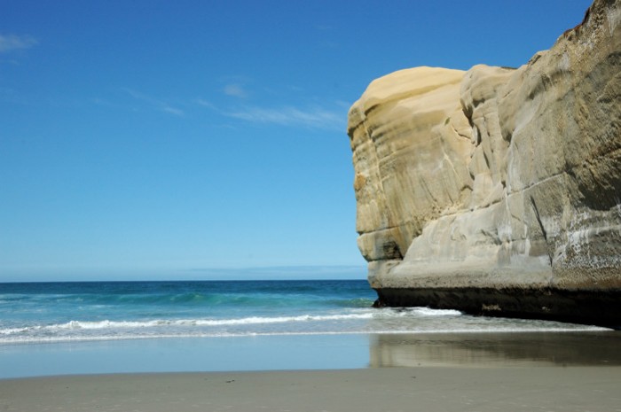
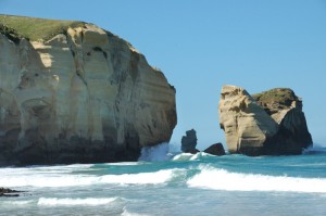
We climbed down the tunnel and came out on one of the first sand beaches we have seen here. The picture below shows the beach and a cliff which is the backside of the headland in the previous picture.

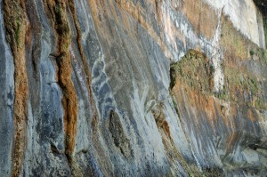
The two photos below show the headland on the other end of the beach and a piece of the cliff near the beach, which looks like it could be a tapestry or a wallpaper design. Together, they make this beach inaccessible, except by water or the tunnel.


The photo to the right shows a beautiful section of the cliff behind the beach.

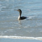
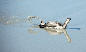
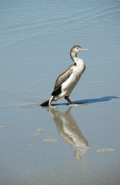
There were a number of people there, some of whom were braving the icy cold water to swim briefly. There was also the bird in the photo below. Related to the Stewart Island Shag, this is a Spotted Shag or Parekareka (Phalacrocorax punctatus). Here he looks like he is truly a water bird.


However, watching him, it soon became clear that being in the water was not his natural element and that, in fact as you can see to the right, he was waterlogged and having trouble getting up.

Here you can see he did finally succeed in standing up and began to dry off. However, when some of the other people on the beach scared him, although he managed to fly, he could not get very high, and when he tried to land on the cliff he could not get a good hold and slid back into the water, where he had to start again. We saw this entire process repeated twice! We hope that he made it.

After leaving the beach we went for ice cream. This is Liz and Matai at the ice cream shop. I’m sure that Liz would want it made clear that Matai’s face is fine; however, he was very proud of the ink stamps that he had put on his face that morning.

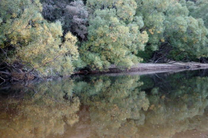
After that they took us to a scenic reserve (apparently their names for parks; however as you can see below, it actually was quite scenic) on the Taieri River. There they let their dogs, which had had to wait in the car while we were at the beach, run free and chase sticks in the river. To finish the day we all went for dinner in Mosgiel.


This post more or less catches us up on the things we have been doing up until now. But things are undoubtedly about to pick up again. This evening the girls will arrive by bus after their trek across the North Island.

Posted in New Zealand, Uncategorized | 1 Comment

University of Otago

Our excuse for being in New Zealand is the month that I am spending visiting with my colleague Liz Franz who is in the Psychology Department at the University of Otago. It is a good time for me, because I have no responsibilities (to teach or otherwise), and out-of-sight, out-of-mind seems to describe my interactions with colleagues at UCI. So I have had lots of time to work on a paper and analyses for other research, talk with Liz and her students, and just think.

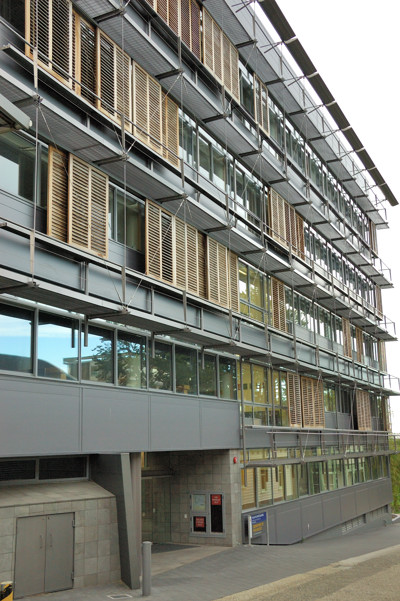
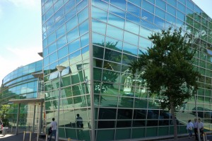
Otago is the oldest in New Zealand’s system of universities and has become the one of the universities with the strongest research focus. Psychology is the highest ranked of the university’s departments and so is well supported. One manifestation of this is the new William James Psychology building in which I am working, which is pictured to the right. This is probably not the most flattering picture of this modern building but it does highlight one of its more interesting, or perhaps arcane, features. The building has been designed to be energy and resource efficient. Although I cannot see it, apparently it has a grass covered roof. Rain water is captured and used for the toilets in the building — you can see that; the water in the toilets is brown. All the lights are on motion sensors – if you sit without moving for even 30 seconds they turn off. However, there is a lot of glass to let in light and many of the windows open. One potential problem with all this glass that the north facing windows (yes, north down here) can get too much sun. So, as you can see in this picture, each floor has a set of sliding, louvered shades that can be placed in front of windows with this problem. But how are such shades moved to the right place? I am told that in strong winds they move on their own. Yes, you can open a window and try to reach out and slide one a few feet. Just the thought scared me when I leaned out one of the windows to consider this. It appears that the “solution” is the set of walkways that you can see below the shutters. However, it is not clear how one actually gets onto these – they are too low to step onto from the windows – or who has to do it. Very strange.

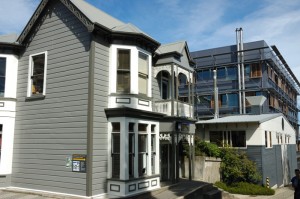
Of course like most campuses, this one is actually an amalgam of new and old buildings. The psychology department inhabits 5 buildings in a cluster connected by walkways. You can see 3 of them here: the beautiful old house in the foreground, the William James Building in the background, and a utilitarian metal structure in the middle.

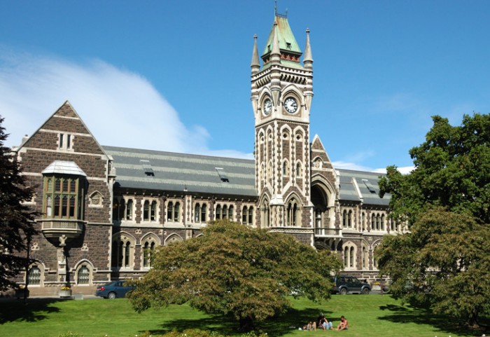
Shown below is one of the buildings that make up a quadrangle that was the original University of Otago. Of course, the varsity – a term here used synonymously with university – was much smaller then. It has grown now to over 20,000 students (still only about two-thirds the size of UCI) with a large hospital attached.

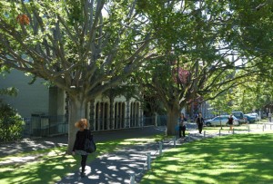
Like most modern campuses, it has tree-lined pathways and its share of all glass modern buildings.


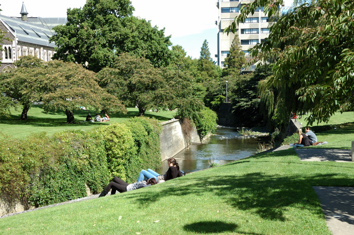
One of the nice features of this campus is that the Leith River curves through it. Although the river itself, which is concrete lined with water that looks dirty and uninviting, is not all the pretty, it creates around it many pretty spaces. Another positive feature, for which I do not have any pictures, is the wonderful new library and student center building. Both have many comfortable spaces and provide easy access to things that students need. This building definitely seems to be a success given how heavily used it seems to be every time I have walked through it.

Posted in New Zealand, Uncategorized | Leave a comment

A Day in Central Otago

Yesterday being Sunday, we decided to attend a service at St. Paul’s, the Anglican cathedral in Dunedin. This was especially fun today because it was Commonwealth Day, so, in addition to the singing of a small, but wonderful mixed, adult choir, we were treated the congregation singing “God Save the Queen,” the reading of the Queen’s Commonwealth Day proclamation, and a rendition of the Commonwealth Day poem. There were many women and girls taking part in this service, because the Queen’s proclamation was about “Women as agents of change.”

The weather yesterday was also, as they say here, “fair,” if not outright gorgeous. We had been disappointed the day before. After going to the Farmers Market, we had intended to drive to Aramoana, the tip down at the end of Otago Harbor across from the Otago Peninsula where we had explored last weekend. [I realize that I have still to write about some of the things that we have done since getting to Dunedin ans this is one of those things.] However, it quickly became clear that there was not enough visibility to make that trip worthwhile.


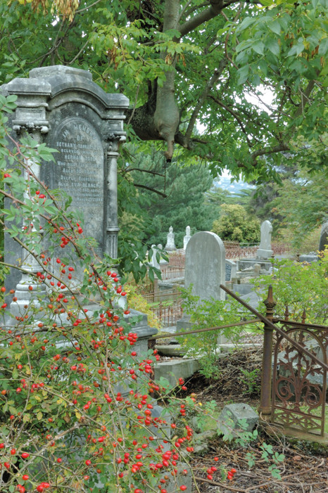
Instead, we drove back into Dunedin, where we simply wandered through a section we had not previously explored. Here we stopped to watch some of a boys’ cricket match and a pick-up game of touch rugby. We also stumbled onto this old grave yard, with grave stones mostly from the late 1800s.

One thing that we thought we might do when the girls are here is bike (or hike) part of the Otago Rail Trail. This was a railroad line to the Otago gold fields and has now been converted into a hiking and biking trail through want is meant to be a section of Central Otago known for its landscape.

It takes 4 days to bike the entire trail; however, even if we wanted to do it all, we probably have at most 2 days free to do it.  So we decided to reconnoiter by driving along it to Ranfurly, which is about at the half way point. The initial section of this half of the trail from Middlemarch to Hyde did not seem that special; however, the next section from Hyde to Waipiata seemed great. Of course we were on the road not the trail. Also, the people we talked to in Ranfurly, who had been out biking, raved about a section west of there from Lauder to Auripo.  So, if we can work out the logistics, perhaps we can do some of this. Another reason why the girls might enjoy this trip is that, oddly enough, in Naseby, just 14 km from Ranfurly is a world-class, indoor Curling rink. Ever since they saw curling on TV, the girls have always told us that they thought curling would be their ticket to Olympic participation.

Driving to Ranfurly, we had gone west from Dunedin and then north to Middlemarch. Rather than drive back the way that we had come, we drove east to Palmerston and then headed south close to the coast. The two routes diverge at the Kyeburn River. This is where I took the photo below.

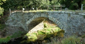
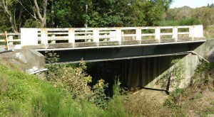
Coming into Plamerston is where we came across Bowker’s Bridge. This is the last remaining example of the stone arch bridges that had been used for a coach road that ran along this route. Amazingly, it was in use until 1962, when it was replaced by the testament to the bridge-builder’s art on the left.


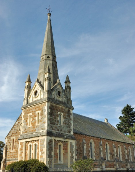
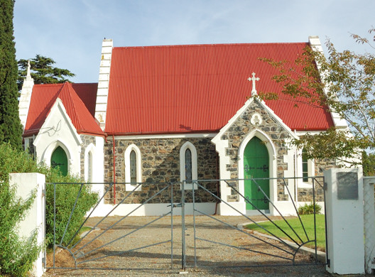
Palmerston is also where we stumbled onto the gorgeous church, shown in the photo on the right, St. Jame’s Presbyterian. The Anglican church shown below, which was just around the corner, St.Mary’s, was also charming, if somewhat less impressive.

From Palmerston, we could have simply driven home on SH 1 in 45 minutes. However, Liz Franz, the professor whom I am visiting here, had raved about the train (for tourists only) ride from Dunedin to Palmerston so we tried, given the limitations of the roads and our maps, to follow its route south. South of Waikouati we got on a wonderful coastal road that runs through Karitane and Seacliff before joining up with SH 1 again at Evansdale.

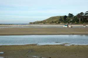
We had something of an adventure in Karitane. It was close to low tide and, since we had been driving for a while, we decided to stop at a spot where the Waikouati River enters the ocean near the Huriwa Historic Reserve. Our plan was to take off our shoes and roll up our pants legs so we could walk out onto a sand bar in the river there. This photo, although not otherwise all that interesting, may help to make what follows more comprehensible. The sandbar is the middle of the three patches of sand. It divides the river here into two channels, which come together at the right and make a hard left turn to enter the ocean, which you can just see past the third patch of sand. The hill in the background is part of the Huriwa Reserve.

We were able to cross the sandbar in just a foot or so of water. To the left you can see the bottom of the part of the river we were walking across. The photo below is taken from the sandbar.

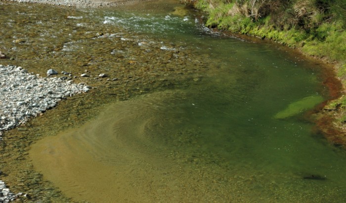
While we were walking across the sand bar, we noticed that a strong current had begun flowing back from the ocean into the far channel. Perhaps you can see it also in the photo below. Looking around, we then saw that the water was quickly starting to cover the sand bar itself. By the time we started back across the channel to the bank of the river where we had left our car, the channel we had just walked through at most 15 minutes previously, now had over two feet of fast flowing water in it that both made walking difficult and obscured the bottom.

We made it across without mishap, although our pants legs got wet. It was such a nice day that wet clothes were hardly a problem; however, we learned an important lesson about how quickly the tide can change here.

Heading south from Karitane, the road climbs to get across a headland. The photo below is from that headland looking back to the north. The Huriwa Reserve is the peninsula in the middle of this photo. The mouth of the Waikouati River is visible at its left side.

Instead of getting on SH 1 again at Evansdale, we again tried (but, as it turned out failed) to follow the route of the railroad and got onto Mt. Cargill Rd. Oddly enough, it was the other end of the road that we had tried to take out of Dunedin the day below, until the fog turned us back. As you can see in this photo, although not so bad, we did not completely escape the fog this day either.

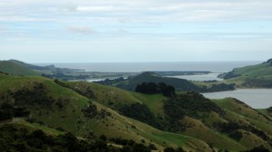
Dunedin is at the west end of the Otago Harbor. By following Mt. Cargill Road rather than SH 1 we went more directly south over the hills and come down about halfway along the harbor near Port Chalmers. The photo below looks down onto the harbor. Point Chalmers is the built up area in the foreground and on the peninsula. Across the water is Portobello, on the Otago Peninsula, which we had driven through last week. The water in the far distance is the Pacific Ocean.


We drove into Port Chalmers, which we found to be a large, active port complete with a big container loading facility. At this point, since it was getting late, we decided to simply make the 20 minute drive back to Dunedin.

Posted in New Zealand, Uncategorized | Leave a comment

Dunedin

If you have been following this blog, you know that there has been a 5-day hiatus in the posts. In part that is because I had gotten up to where we had finished the interesting, initial part of our trip and were settling into a month of work in Dunedin. Also, however, I expected that whoever might be interested in our musings would be at least as interested in those of Taylor and Haywood, who have been blogging about their trip through the North Island at http://taylormwright.com/.

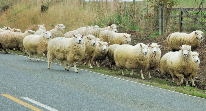
So the day had finally come ending the pure vacation part of this trip. Saying Goodbye to Helen and Graeme, we started the car up the road to Dunedin. Our first obstacle was a flock of sheep being driven to a new pasture along the highway (State Highway #1 even if it doesn’t look that large). Shades of our episode with the cows just two days before, however, this time the farmer’s wife was in a car at the back of the herd telling us that we should drive on through and they would move. Nina, who was driving again today, shared my trepidation about this maneuver; however, we watched a truck just plow through coming from the other direction and, as we inched forward, sure enough these big, wooly sheep got out of the way.

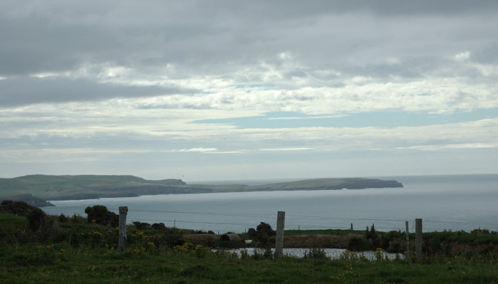
Another obstacle was that we were driving through the Catlins, the gorgeous coastal area that is the southeast part of the South Island. However, rain was coming on and we had an apartment to get to and food and other things to find and purchase in order to settle in. So except for a few stops – here at Florence Point – we mostly just drove through.

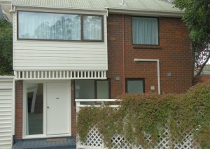
This is our home for the next month: 30 Heriot Row, Apt. 4. We have this entire building, a 3 bedroom apartment, with a kitchen, living-dining room, two shower rooms (one with a washer and, unusual for here, dryer – mostly people use lines), and one toilet room. This is more than enough for us, even when the girls join us later for a week. We had hoped that we might entice someone else to come to visit – but it is a LONG way.

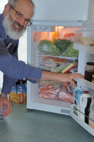
[It might seem strange to some, but I am planning to cook most of our meals here. The kitchen, although smaller than at home and only marginally well equipped, is adequate for that (although those of you who know me well, know that I have brought my own knives). The only serious problem is that I feel a little like Gulliver with this Lilliputian refrigerator. Here it is on a Saturday after we have been to the farmers market.

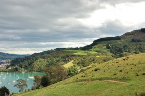
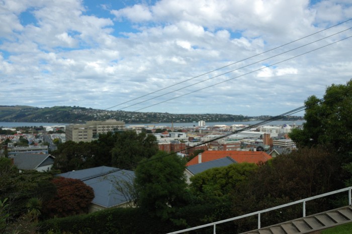
The apartment is on one of the hills above Dunedin. The photo below is the view out over the city from where we are. The water in the middle distance is Otago Harbor. It is at the end of a 20 km channel to the Pacific Ocean, protected by Otago Peninsula. The land in the middle distance is that peninsula, which connects to the mainland off to the right of this picture. Although, it is not possible to see, the Pacific is also just on the other side of this peninsula, and the beaches in South Dunedin are on the Pacific. The channel that forms Otago Harbor is not that deep, so large ocean going vessels including, the cruise ships that come here, all dock 10 km away at Port Chalmers.

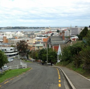
Did you see the steps in the foreground of the photo above? Being up on the hill gives us nice views, but it also gives us steep walks down to the university and the city center, which are both less than a mile away.

Dunedin was settled by immigrants from Scotland. Those who purchased the land and planned a grid layout for their city had never actually been here and seen the landscape. When they arrived and discovered how hilly it is, they went ahead with their planned city layout. Maybe they thought this was God’s will – they were seeking religious freedom – or maybe they were just stubborn, the result, however, is a city with some really steep streets and one that is claimed to be the steepest in the world. Dunedin became rich with the Otago gold rush. This wealth allowed them to deal with these streets, by inventing a system of cable cars. Later they shared the design with San Francisco. Still later, they ripped them out, much to the dismay of our legs.

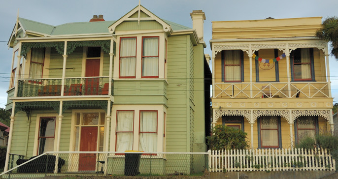
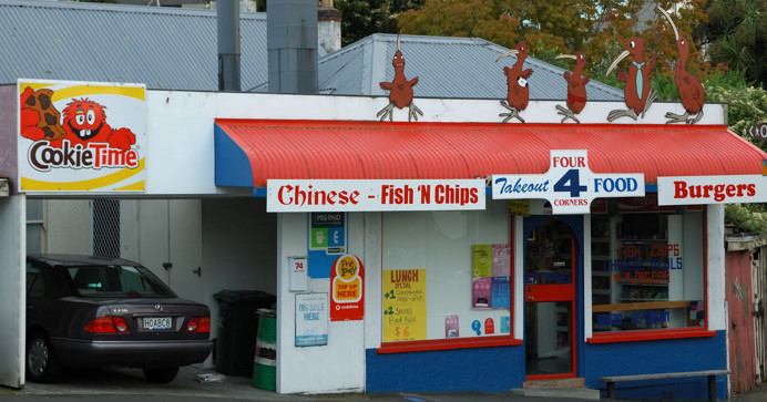
The area that we live in seems to be serving mostly as housing for people associated with the university. So there are a lot of interesting old houses, like the two above, which are being lived in, but not maintained in their original glory. Fortunately, the undergraduates – at least as distinguished by the large piles of empty beer bottles being recycled – seem to mostly live further down the hill, and so that up where we are has been quiet and quite pleasant. This is also an area with a broad mix of cultural and ethnic backgrounds. I think that the photo below captures this wonderfully. The birds prancing on the roof are kiwis.

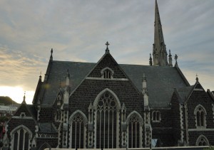
However, the foundation of Dunedin is a set of fine, old buildings, many of them built using similar materials in a common style. The Presbyterian church shown to the right, which is just three blocks from us, is one of those.

Posted in New Zealand, Uncategorized | 1 Comment